Showing posts with label Arunachal Pradesh. Show all posts

Tuesday, 14 February 2017

The Ita Fort at Itanagar was built in the 14th or the 15th century. It is said that the city of Itanagar got its name from the fort itself. 
The fort is built in an irregular shape by a king of Jitari dynasty, Ramachandra. It is believed that 80 lakhs of bricks were used for constructing the structure of the fort.
The fort has three different entrances at three different sides, which are western, the eastern and the southern sides. 
Apart from exploring this fort on foot, one can visit Indira Gandhi Park, which is at a distance of about 2 kms from here.
How to Reach
By RailThe closest railroad station is Harmuti in Assam. It situates at a separation of 55 km from Itanagar. There are regular taxi administrations from Harmuti to Itanagar. Therefore, Harmuti very much associates with different urban areas in the North East.
By BusItanagar has a decent street system. There are overnight express transports which associate Itanagar to Guwahati. Aside from that, the Arunachal State Transport Corporation run government transports interface Itanagar to different urban communities in the North East too.
By AirLilabari in Assam is the closest airplane terminal to Itanagar. Found 68 km from Itanagar. Lilabari very much associates with flights from Guwahati.

Ita Fort,Arunachal Pradesh,India

Sunday, 12 February 2017

At an elevation of 5,000 m above the sea level, the Bum La Pass marks the Indo-China border. A prominent attraction of Arunachal Pradesh, the place is a must visit but only when you have the special permit from Office of the Deputy Commissioner in Tawang District, and then Indian army cantonment of Tawang. 
The place instantly evokes a feeling of patriotism, especially after watching soldiers protecting the border that too in such nerve-wracking weather condition. Also, it was through this pass, Dalai Lama entered India.
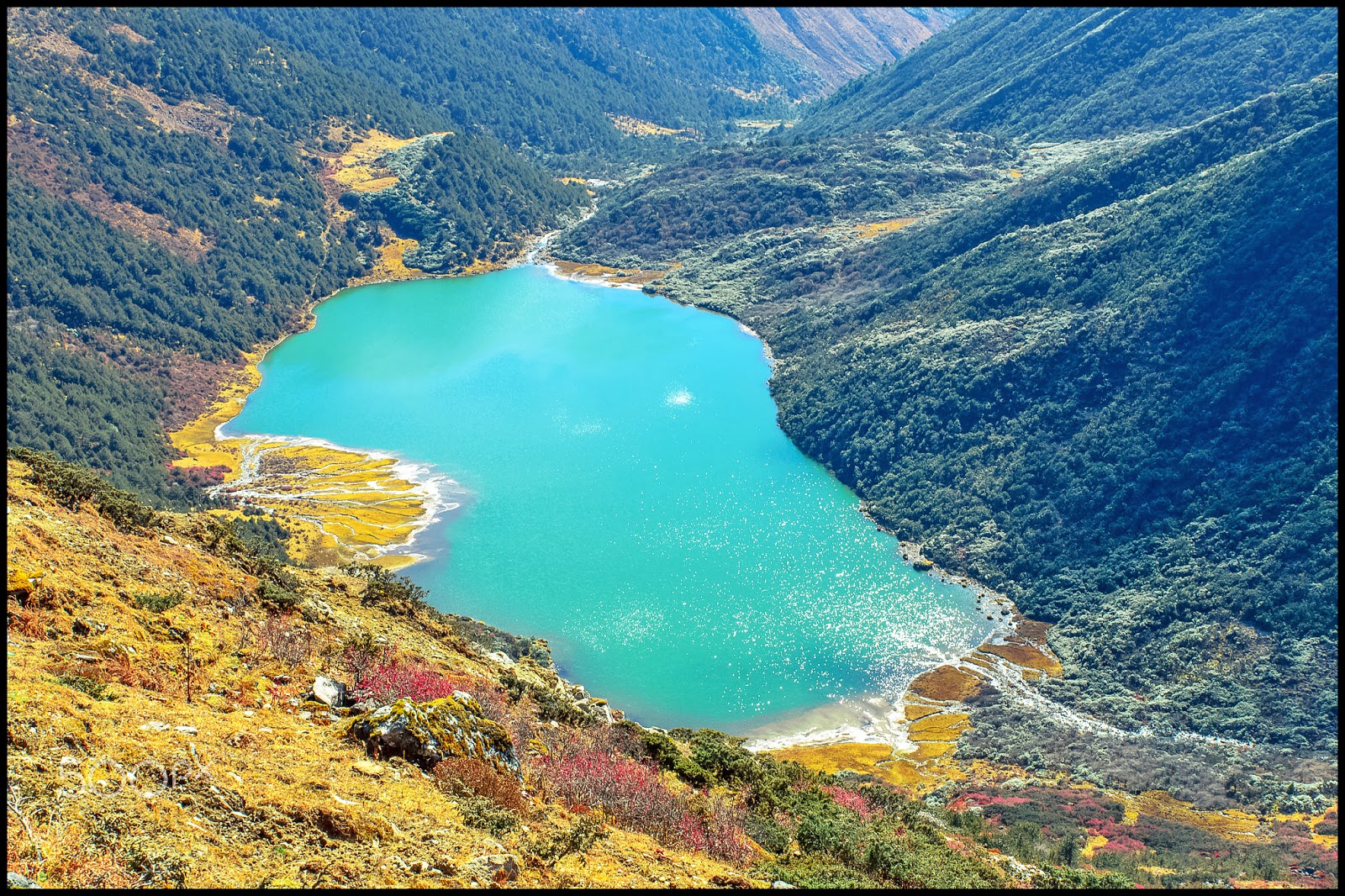
When on a visit to Bumla Pass, make a point to see the route from where Dalai Lama entered India to take a refuge. Also, there's a lake called Sangestar Tso, which is worth a watch.
You can also see the Indo-China Border Personnel Meeting (BPM) Point, which is one of the four meeting points between Indian Army and People's Liberation Army of China for regular consultations and interaction.
How to reach 
Tezpur in the nearest airport. After reaching Tezpur one can hire a cab for Tawang( costing around 5k) or share a cab with others( 1500 each). A trip to Bum La costs 2000 rupees for a Tawang-Bum La-Tawang trip. It is noteworthy that Arunachal Pradesh is closed for foreigners and Indian citizens need a inner line permit to enter the state.
For going to Bum La, permit should be taken from the DC office, and the same has to be stamped in the cantonment of Tawang. Please note that without the army stamp, you will not be allowed through the numerous check posts on the way. The army cantt. is open for civilians after 5 pm weekdays. 
Bumla Pass is reachable only by road, after receiving special permits. It is 37 kms away from Tawang. From Tawang to Y-junction is a 22 Km distance which has a metalled road, the rest 15 Kms are gravel road. This road is one of the shortest connectivity points to China from Tawang (India). On the Chinese side, the nearest major town Tsonajong is 43 Kms from Bumla border post.

Bumla Pass- Arunachal Pradesh - India

Friday, 10 February 2017

Also known as Jang falls or Bong Bong Falls, Nuranang waterfalls are located around 40 km from Tawang town. These waterfalls are placed at an elevation of around 6000 feet and are one of the most stunning waterfalls in Arunachal Pradesh state. 
The locals believe that this milky white waterfall has been named after Nura, a Monpa tribal girl who probably helped an Indian soldier by supplying arms and also gave shelter to him at the time of Indo-China war. 
One of the most spectacular waterfalls in the country, the Nuranang Falls are a beautiful white sheet of water that descends from the height of about 100 meters. 
Nuranang waterfall has crystal clear water which elevates your spirits and encourages you to indulge in swimming. 
After visiting the falls, you can also pay a visit to Hydel power station, which is placed nearby. Regular bus service is available from Tawang to reach Nuranang falls. 
How to reach
Reaching the location through road is the only mode of transport. Tawang is the best destination to reach Nuranang. Tawang is easy reaching location of AP and countless buses are available from various parts of the state.

Nuranang Waterfall- Arunachal Pradesh - India

Wednesday, 8 February 2017

Located in the Tawang-Chu river valley, in Arunachal Pradesh, India, at an elevation of 3300 meters, the wonderful Tawang monastery is one of the most important and largest Buddhist shrines in the world. 
This holy shrine, located in the midst of majestic mountain ranges, is home to more than 700 monks and 450 Lamas, making it the biggest Buddhist Monastery in India, and the second biggest in Asia, outside of Lhasa, Tibet.
Losar and Torgya are the popular festivals celebrated in the monastery. Celebrated in February, the Losar festival marks the beginning of the New Year. This 15 day festival is celebrated by lightening lamps, hosting prayer flags and offering prayers.
The best time to reach Tawang Monastery is in between April to October. One can also visit during the time of Losar festival which is in between February and June.
Tawang monastery is one of the most important Buddhist shrine located in a scenic backdrop in the lap of the majestic mountains and is worth visiting at least once in a life-time.
How to Reach
By Air: The nearest airport is at Tezpur (Assam), which is at a distance of 365 kilometers. Tezpur is directly connected to Kolkata (West Bengal) by two flights weekly. Another option is Guwahati (Assam) which is 555 kilometers away from Tawang and is connected to different parts of the country by daily flights. 
By Train: Guwahati, located at about 555 km from Tawang has the nearest rail station, which is also connected to all the major cities in India. 
By Road: State transport and private bus services are available to reach Tawang. Commercial taxi services are also available. The nearest bus services are from Bomdila (185 km), Tezpur (365 km) and Guwahati (555 km). 
Book your Tawang Monastery Holiday with our affiliate partner Booking.com

Tawang Monastery- Arunachal Pradesh - India

Monday, 6 February 2017

One of the most breathtaking places in the Himalayan vista, Sela Pass is a lifeline for the people of Arunachal Pradesh, and the Sela Lake is as heavenly as it gets. The two combine to enchant one and all by their mystic beauty. 
One of the most stunning gifts of nature to the North-East, Sela Pass is a lifeline for the people of Arunachal Pradesh as it is the only way that connects Tawang district of the state to the rest of the country.
Besides its geographical importance, Sela Pass is breathtaking place always covered in snow providing some beautiful views of the eastern Himalayan range.
The beautiful Sela Lake is located close to the Sela pass. It is a heavenly crystal blue water lake surrounded by snow-clad mountains. This lakes remains frozen during winter season.
How to reach
By Air
Nearest airport from Tawang is located in Tezpur (Salonibari Airport) at a distance of 387 km. The airport is directly connected to Kolkata and Guwahati through Air India flights. In October 2014, Government of Arunanchal Pradesh Government started helicopter facility to connect Tawang and Guwahati. The service is available twice a week.
By Road
Best way to reach Tawang through road is via cab or bus services. Arunachal Pradesh State Road Transport Corporation (APSRTC) and other private agencies have introduced regular bus services, 
By Train
Nearest railway station from Tawang is Rangapara Railway Station, at a distance of 383 km. It is well connected to major cities and towns of North-east India. About 88 stations are directly connected to Rangapara Railway Station.

Sela Pass- Arunachal Pradesh - India

Saturday, 4 February 2017

Also known as Gentse Gaden Rabgyel Lling monastery, Bombdila monastery was built in 1965 by the twelfth incarnation of the Tsona Gontse Rin poche. And was rebuilt by the thirteenth reincarnation, Tsona Gontse Rin ponche renovated the monastery by building a larger prayer hall.
The monastery was inaugurated in the year of 1965. This monastery is considered to be same as that of the Tsona Gontse monastery which is in Tibet.
The monastery has three layers- The Upper gompa, middle gompa and the lower gompa. There is also a huge prayer hall made where the monks and lamas and other visitors offers their prayer. Apart from these the monastery also has quarters for the monks and they also have school where the young monks are taught about buddhism and other subjects.
Apart from its religious significance, the monastery is also known for its natural beauty. Stunning vistas that you can see from here are fabulous and breathtaking.
The best time to plan a visit to plan a visit to the monastery will be during the Losar Festival, which is commemorated to mark the new year.
How to Reach
By Air:
Tezpur in Assam is the nearest airport. Located at a distance of 160 kilometers from Bomdila, this airport is connected to all major cities of India.
By Road:
Bomdila is easily accessible from Guwahati (338 kms) and Tezpur (153 kms) with well-connected roads and mesmerising views on the way. However, being a hilly route with a number of hairpin bends, it is advisable to go with an experienced driver or take one of the Arunachal Pradesh State Transport Company or Assam State Transport Company buses. 
By Train:
Rangapara railway station in Assam (144 kilometers from Bomdila) is the nearest railway station, with frequent trains to a number of locations.
Book your Bomdila Monastery Holiday with our affiliate partner Booking.com

Bomdila Monastery,Arunachal Pradesh,India

Thursday, 2 February 2017

Namdapha, a Tiger Reserve and National Park, a true wilderness and enchanting beauty of lush green vegetation, impenetrable pristine and virgin forests covered an area of 1985.23 square kilometres having diverse flora and fauna lies in the international border between India and Myanmar(Burma) within Changlang District in the state of Arunachal Pradesh in the northeast India.
The lush green under growths are thick and intertwined like cobwebs of canes, bamboos, wild bananas and variety of vegetations The grandeur of the wet tropical rain forest is breeding ground for varieties of animals and birds which is remarkable and worth seeing.
The nearest town is Margherita which is 62 km from the national park. The national park is famous for its wonderful varieties of spices and vegetation. It will be a wonderful holiday with nature and her various forms.
The cold weather and the stability of the temperature give the animals to have comfortable days. Being a hilly area the place always remains crowded with colorful birds and their vivacity.
Apart from bird there are Elephant, Wild Goat, Gibbon, Assamese Macaque, Mongoose, Musk Deer, Takin, Goral and a large number of rodents like squirrels, porcupine and Mithan.
How to Reach
By Air
The nearest airport to reach the Namdabha National Park is at Mohanbari, Dibrugarh in Assam at about 182 kms away. Guwahati Airport in Assam is the nearest International airport.
By Rail
The Namdabha national park can be reached by from the major cities of India through the nearest railway station from here at about 141 kms in Tinsukia, Assam. The nearest passenger railway station is about 91 kms away from here in Margherita, Assam.
By Road
It is well connected with roads upto Miao which is the entry point of Namdabha and to Tinsukia, Dibrugarh and Margherita which are about 141 km, 186 kms and 91 kms respectively.

Namdapha National Park,Arunachal Pradesh,India

Thursday, 30 June 2016

Breathtakingly beautiful, the hill station of Bomdila, situated at 3,500 metres in the Himalayas, is the headquarters of the west Kameng district in Arunachal Pradesh.
The town is famous for its apple orchards and awe-inspiring views of Kameng valley and snow-capped mountains making it a wonderland for nature lovers. The lush greenery of the place makes every traveler relax like never before.
The important places of interest in Bomdila include Tibetan monasteries, Orchid research and development, ethnographic museums and craft center.
Bomdila not only serves its visitors with its scenic charm and important places of interest, but also with several exciting adventures including hiking and trekking.
You may also visit Tawang Town around 237km away, a town with 400 years old Buddhist monastery. Bomdila is also famous for some unique buys such as Tibetan carpets, beautiful painting and thangkas exhibiting a large section of tradition of Buddhist and Tibetan culture.
Bomdila in Arunachal Pradesh, is an excellent place to get a panoramic view of the entire city and the hills. It is well connected through Tezpur and is home to some of the best apple orchards and the huge Bomdila monastery. 
How to Reach
By Air
The closest airport is situated at Tezpur which is at the distance of about 160 km from Bomdila. You can hire a cab or catch a bus from the airport to reach Bomdila.
By Road
Bomdila is well linked by road to the cities of Tezpur, Guwahati and Rangapura. There are several buses, cabs and taxis running frequently between these towns. You can also drive your own vehicle to reach Bomdila.
By Train
The closest railway station is in Rangapara, which is at the distance of about 145 km away from Bomdila. Renting a cab from here to reach Bomdila is pretty easy. Alternatively, you can also book a seat on the buses that run regularly from Rangapara to Bomdila. 

Book your Bomdila holidays with our affiliate partner Booking.com 

Bomdila,Arunachal Pradesh,India

Monday, 27 June 2016

Apart from being the nature lover's paradise, Bhalukpong can provide you a complete experience with wildlife and a host of activities complimenting its natural beauty and the environment of a place lesser known
The Assam side of Bhalukpong has large number of shops lined up till the border. This is where most tourists buy there general consumables such as bottled water etc as the cost goes up and availability continually reduces as you go higher up within Arunachal.
The Kameng River running in the forest surrounding it makes the town even more attractive. In Bhalukpong you'll find yourself making the most of hiking, trekking, camping and fishing.
The town has check-post, which is used to check Inner-Line-Permit for entering Arunachal Pradesh, each and every traveler must need an ILP. After your permit verification you are allowed to visit the state.
It is an attractive destination for wildlife admirers and nature lovers. It is situated at West Kameng district in Arunachal Pradesh and is nearer to Assam-Arunachal Pradesh border. The Kameng River running in the forest surrounding, makes the town even more attractive.
October and November is best time to visit Bhalukpong, another good time starting from March to April. Adventure loving tourists can visit throughout the year. 
How to Reach
By Air :
The nearest airport is Lilabari Airport, which is 230 kilometers from Bhalukpong. From the airport, one can book overnight buses to reach Bhalukpong.
By Road:
Most people who travel by road to plan a holiday in Bhalukpong prefer following NH 37 that passes through the Kaziranga National Park. The most fun part about this journey is that you can see rhinos, elephants and other animals on the marsh lands a little distance off.
By Rail :
The nearest railway station is Rangapara railway station, which is 46 kilometers from Bhalukpong. Trains from different parts of Northeast are easily availabale to reach here. From Rangapara railway, one can book buses and taxis.

Book your Bhalukpong holidays with our affiliate partner Booking.com 

Bhalukpong,Arunachal Pradesh,India

Thursday, 23 June 2016

Anini is where the clouds come down the kiss the land. With much of its beauty peeking from behind the misty air, this unexplored town is the place to visit for pristine calmness.
Lying in the beautiful Dibang Valley district, Anini is marked by pleasant weather and immense natural beauty, making it a tourist's paradise, appearing from the clouds. Its silence, beauty and magic is almost untouched and can relax you to the very core.
While in Anini, one may want to visit the tribal villages here and experience their subtle heritage and colorful cultures. Some of the tribal villages here are New Anaya, Hunli, Ranli and a few more.
Anini is a paradise for tourists. Lovely weather, scenic landscape and untouched beauty make Anini a perfect location for any nature lover.
A humid sub tropical climate prevails in Anini throughout the year. The summer season from April to June has moderate climate and is the ideal time to visit Anini.
How to Reach
By Air: The nearest air terminal is located in Dibrugarh. From there one can take buses to reach Anini.
By RoadTravelling by road is the best way as the drive is beautiful. The roads are well connected to all the main cities of Arunachal Pradesh. Regular bus services also ply on the route. However, the city does lack a road system, which is functional in all seasons.
By Rail: Tinsukia railway station is the closest railway station to the town of Anini.
Book your Anini holidays with our affiliate partner Booking.com 

Anini,Arunachal Pradesh,India

Saturday, 18 June 2016

Located in the state of Arunachal Pradesh, Itanagar is a beautiful city well-known for its Buddhist culture, scenic beauty and tranquility. Nature lovers, history buffs and photographers visit the place from all over the world to explore every bit offered by the city.
Also known as the ‘Land of Dawn-lit Mountains’, Itanagar features a picture perfect landscape including snow capped peaks, lush greenery and soothing weather. The beautiful valleys of the city promise an unforgettable experience to every visitor.
 Itanagar also offers much to adventure lovers with activities like trekking.
The best way to explore Itanagar, is on foot. That way you get to see more of the city and get acquainted with the character of the city better. Apart from that you can also hire autos or taxis which are available on a shared basis. 
The main attraction of the city is Buddhist culture which can be witnessed in every nook and corner of the city, right from historical monuments to shopping centers. 
Itanagar experiences pleasant and cool weather throughout the year. However, the best time to visit the city is from the month of October to March.
How to Reach
By Rail
The nearest railway station to Itanagar is at Harmuti in Assam, which is located at a distance of 52 km from Itanagar. There are regular taxi services from Harmuti to Itanagar and they charge Rs.500-600 for the journey. Harmuti is well connected to other cities in the North East.
By Bus
Itanagar has a good road network and there are overnight express buses which connect Itanagar to Guwahati. Apart from that, the Arunachal State Transport Corporation run government buses connect Itanagar to other cities in the North East as well.
By Air
Lilabari in Assam is the nearest airport to Itanagar. Located 67 km from Itanagar, Lilabari is well connected by flights from Guwahati. Pawan Hans has helicopter services between Itanagar and Guwahati three times a week.
Book your Itanagar holidays with our affiliate partner Booking.com

Itanagar,Arunachal Pradesh,India

Sunday, 12 June 2016

Dirang is a small town in the West Kameng district of Arunachal Pradesh. It is located about 43 km from Bomdila on the way to Tawang. The town is mostly used by tourists for overnight halt on the way to Tawang.
Dirang is a small town on the bank of river Kameng (Known as Jia Bharali in Assam). Since it is at the river valley the altitude is relatively low (4900 ft). The weather here is also not very cold and pleasant during most of the year.
Dirang is your picturesque hill station surrounded by the high mountains of the Eastern Himalayas. It is a small, quiet town situated on the highway from Assam to the Tawang region. Located at about 5,000 feet, it is blessed with great weather and is known for its unique tribes, spectacular views and the pretty valleys nearby.
Dirang Dzong is a city in the State of Arunachal Pradesh. The closest tourism destination to Dirang Dzong is Bomdila. Other close by tourism destinations include Eagle’s Nest Wildlife Sanctuary, Tawang and Majuli. 
It is also used as a base camp for trekking and bird watching at Mandla or Madla Phudong, which is situated at a distance about 28 km from Dirang. Dirang features unique flora & fauna, numerous medicinal plants have their habitat in this area.
The other local attractions, which the tourists visit, are the National Yak Research Center (situated half-way between Dirang and Tawang). The Regional Apple Nursery & Kiwi Farms are situated across the river valley and one has to cross over through a small bridge.
How to Reach
By Air :
The nearest international Airport from Dirang is Lokpriya Gopinath Bordoloi International Airport at Guwahati, which is about 351 kms from the town. It is connected with the major cities like Delhi, Kolkata, Agartala, Imphal, Aizawl, Dibrugarh, Lilabari, Silchar, Dimapur, Jorhat and Mumbai.
By Rail :
The nearest railway station of Dirang is located at Tezpur, which is at a distance of about 193 kms from the town.
By Road :
Dirang can be reached from Bomdila, which is about 41 kms away. Other than this, Dirang is connected through Arunachal Pradesh State Road Transport Corporation bus services with Bhalukpong, Tezpur, Seppa, Nagaon, Itanagar, Guwahati and Shillong.
Book your Dirang holidays with our affiliate partner Booking.com

Dirang,Arunachal Pradesh,India